Date: 06/01/2023
Relevance: GS-2: Functions and Responsibilities of the Union and the States; Parliament and State Legislatures-Structure, Functioning, Conduct of Business, Powers & Privileges and Issues Arising out of these; Cooperative Societies.
Key Phrases: National Database on Cooperative, Ministry of Cooperation, National Cooperative Database, Polarisation of Cooperatives, Heterogeneity and Diversity, 97th constitutional amendment, Part IXB (The Co-Operative Societies) of Indian Constitution, National Geospatial Policy 2022.
Context:
- Recently,a national database on cooperatives has been initiated by the Ministry of Cooperation for single-point access to information on cooperatives of different sectors and to develop a process for better understanding of cooperatives.
Key Highlights:
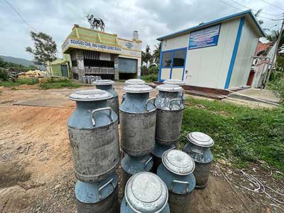
- In the first phase of development of the National Cooperative Database, data collection of cooperatives of three sectors - primary agricultural credit societies, dairy and fisheries - is being taken up.
- Maharashtra has the highest number of cooperative societies, followed by Uttar Pradesh.
- The maximum number of cooperatives are in the field of credit, agro, housing, multi-purpose and dairying.
Progress on the Geospatial Infrastructure:
- National Geospatial Policy 2022 provides the framework to develop
geospatial infrastructure, skills and knowledge, standards and
businesses.
- By 2030, the government will look to establish an Integrated Data and Information Framework, under which a Geospatial Knowledge Infrastructure will be developed.
- A high-resolution topographical survey and mapping as well as a high-accuracy Digital Elevation Model for the entire country will be developed by 2035.
- The national database for cooperatives needs to have geospatial database creation with geo-referencing of cooperative societies to make a decision-support model.
Need for Geospatial Mapping of Cooperative Societies:
- Analyzing the Polarisation of Cooperatives
- The distribution of cooperative societies reflects polarization of
societies in a few States in the west and south while the number of
cooperative societies in the east and northern parts is low.
- Geospatial mapping of these cooperatives will help to analyze the reason for such polarization.
- The distribution of cooperative societies reflects polarization of
societies in a few States in the west and south while the number of
cooperative societies in the east and northern parts is low.
- Understanding of the Heterogeneity and Diversity
- The cooperative movement is all set for acceleration of membership.
- The plan of acceleration requires an understanding of the heterogeneity and diversity in spatial distribution.
- The cooperative movement is all set for acceleration of membership.
- Understanding the Contrasting Diversities
- Some contrasts are seen like nil dairy cooperatives in the North-East States of Manipur, Nagaland, Mizoram, Meghalaya, while Sikkim is better positioned.
- Fisheries cooperatives are also formed around inland water
resources in contrast to coastal lines in the western and eastern
parts of the country.
- It is essential to map these contrasting diversities and analyze the reasons, which could be the resource base of the State.
- It is essential to undertake research on the major parameters that contribute to the development of such societies and their distribution in specific regions.
- District-wise mapping of cooperatives
- District-wise mapping of cooperatives along with database collection is essential to provide a more precise picture of cooperatives at the State and national levels.
- The advanced geospatial tools and technologies will help in predicting, analyzing, modeling, and visualizing spatially explicit information.
Co-operative Societies
- About
- Cooperatives are organizations formed at the grassroots level by people to harness the power of collective bargaining in the marketplace.
- This can mean different kinds of arrangements, such as using a
common resource or sharing capital, to derive a common gain that
would otherwise be difficult for an individual producer to get.
- Amul is perhaps the best-known cooperative society in India.
- On July 6, 2021, the government carved out a separate Cooperation Ministry.
- Constitutional Provision
- Cooperatives are a state subject under the Indian Constitution.
- They come under the state governments’ jurisdiction.
- However, there are many societies whose members and areas of operation are spread across more than one state.
- For example, most sugar mills along the districts on the Karnataka-Maharashtra border procure cane from both states.
- Through the 97th constitutional amendment, Part IXB (The Co-Operative Societies) was inserted into the Constitution.
- The right to form cooperative societies was included as Right to Freedom under article 19 (1).
- Article 43-B (Promotion of Cooperation societies) was inserted as one of the Directive principles of state policy.
- Cooperatives are a state subject under the Indian Constitution.
Way Forward:
- The proposed database shall facilitate all stakeholders in policy-making and implementation to strengthen the cooperative movement in the country.
- Thematic GIS mapping along with research and analysis of the
distribution of cooperative societies is to be committed towards addressing
the developmental issues at the grassroots level.
- PACS serve as a micro-level database for the planners and administrators.
- And as these are being computerized, they can be further integrated with geospatial analysis for querying, analyzing and displaying datasets in the form of graphs and summarized tabular data for all cooperatives.
- The geospatial mapping of the cooperative ecosystem will generate ease of doing business outcomes.
- The geospatial techniques have the potential to be utilized to conduct in-depth mapping and analysis which will be of immense help to planners, managers and administrators in quickly storing, retrieving and updating the required information for the management of cooperatives.
Conclusion:
- The geospatial mapping of the cooperative ecosystem has the potential to enhance the cooperative movement’s visibility, networking and partnership opportunities.
Source: Business Line
Mains Question:
Q. What is the geospatial mapping of the cooperative societies and how can it be beneficial for the policy makers? (250 Words).