Context:
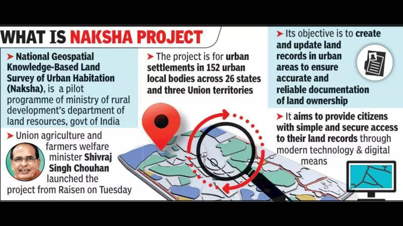
The Ministry of Rural Development recently launched a pilot project called "National Geospatial Knowledge-based Land Survey of Urban Habitations (NAKSHA)" to modernize urban land records using geospatial technology.
About NAKSHA Project:
NAKSHA was announced in 2024 as a part of the Digital India Land Records Modernization Programme (DILRMP). It aims to create and update reliable documentation of land ownership in urban areas, enhancing transparency and minimizing disputes.
· Coverage: NAKSHA is currently in its 1-year pilot phase, which is being conducted in 152 Urban Local Bodies (ULBs) across 26 states and 3 Union Territories (UTs). After successful completion of the pilot program, it is expected to be rolled out nationwide.
· Technical Partner: The Survey of India is the technical partner for the project, responsible for conducting aerial surveys and providing orthorectified imagery to ensure accurate mapping.
· Platform Development: The end-to-end web-GIS platform for NAKSHA is being developed by the Madhya Pradesh State Electronic Development Corporation (MPSEDC).
· Coordination: The initiative is being coordinated by a State Level Committee (SLC), which operates under the Chief Secretary’s office, ensuring effective implementation and monitoring at the state level.
Significance of Digitizing Land Records through NAKSHA
1. Empower Citizens: NAKSHA ensures citizens have legal documentation of land ownership, thereby empowering them with clear, legal rights over their properties.
2. Reduces Disputes: Digitized and legal land documentation helps minimize conflicts over land ownership, leading to reduced judicial burden related to land disputes.
3. Enhances Governance: With transparent and efficient digital documentation, NAKSHA supports better governance by improving the ease of urban planning and decision-making.
4. Boosts Investment: The digitalization of land records promotes ease of doing business and positions cities as attractive investment hubs, stimulating economic growth.
About DILRMP (Digital India Land Records Modernization Programme)
The Digital India Land Record Modernization Programme (DILRMP), previously known as the National Land Record Modernization Programme (NLRMP), was launched in 2008 by the Government of India with the purpose to digitize and modernize land records and develop a centralised land record management system.
It is a Central Sector Scheme funded entirely by the government (100% Centre funding).
DILRMP has been extended for a five-year period, with its duration from 2021 to 2026.
Key Components:
-
- Computerization of land and registration records.
- Digitization of revenue courts.
- Integration with Aadhaar (voluntary) for authentication and land ownership verification.
- Computerization of land and registration records.
Other Key Initiatives:
-
- Unique Land Parcel Identification Number (ULPIN), also known as Bhu-Aadhar: This is a unique identifier for each land parcel, aimed at preventing duplication and fraud in land records.
- BHOOMI SAMMAN: A recognition program to appreciate efforts in land record digitization and modernization.
- Unique Land Parcel Identification Number (ULPIN), also known as Bhu-Aadhar: This is a unique identifier for each land parcel, aimed at preventing duplication and fraud in land records.


