NISAR satellite and growing India US space cooperation
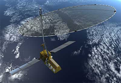
Indian Space Research Organisation (ISRO) has recently completed development of a Synthetic Aperture Radar (SAR) capable of producing extremely high-resolution images for a joint earth observation satellite mission with the U.S. space agency National Aeronautics and Space Administration (NASA). NISAR” is a joint collaboration for a dual-frequency L and S-band SAR for earth observation. According to NASA, NISAR will be the first satellite mission to use two different radar frequencies (L-band and S-band) to measure changes in our planet’s surface less than a centimetre across.
NISAR stands for The NASA-ISRO Synthetic Aperture Radar (NISAR) mission. NISAR is a joint Earth-observing mission between NASA and the ISRO.
Benefits of the NISAR project :
- NISAR's data can help people worldwide better manage natural resources and hazards, as well as providing information for scientists to better understand the effects and pace of climate change. It will also add to our understanding of our planet's hard outer layer, called its crust.
- NISAR’s global and rapid coverage will provide unprecedented opportunities for disaster response, providing data to assist in mitigating and assessing damage, with observations before and after disasters in short time frames.
- Earth’s surface is constantly changing as a result of both natural and human processes, and humanity’s exposure to natural hazards is increasing. NISAR will measure these changes, from small movements of the crust up to volcanic eruptions.
- NISAR will determine how the behavior and evolution of ice masses will contribute to sea level rise. NISAR will measure changes in sea ice, snow extent, permafrost, and surface melting. Ice sheets, sea ice and glaciers, which are all key indicators of climate effects, are undergoing dramatic changes. Rising sea level from melting ice sheets poses hazards to coastal areas from storm surges and erosion. Diminishing sea ice is changing shipping lanes and the availability of resources. Measurements taken now will be used to predict future changes.
- NISAR will also provide a time history of ice sheet and glacier behavior. It will provide precise measurement of the changing position of ice sheet grounding lines.
- NISAR radar data will observe the distribution of vegetation and biomass to understand changes and trends in ecosystems to better understand ecosystems’ responses to disturbance and recovery.
- NISAR will determine the contribution of Earth’s most variable biomass to the global carbon budget and characterize ecosystem disturbance and impacts on biodiversity.
- NISAR will also be capable of measuring changes in groundwater reserves across the land. Climate change, coupled with growing populations, is causing increasing stress on groundwater resources globally. By measuring changes in Earth’s surface, we can understand processes occurring below the surface. Subsidence is often the first indication of changes in reservoirs or over-exploitation of aquifers. Subsidence that continues for too long can lead to irreversible collapse of the aquifer system. Informed decisions allow us to make the most of our resources sustainably and economically.
- NISAR’s unique combination of radar, frequent orbit passes and polar orbit also mean that the satellite can be used to study floods, precisely measuring very small changes of water level in areas with standing vegetation.